
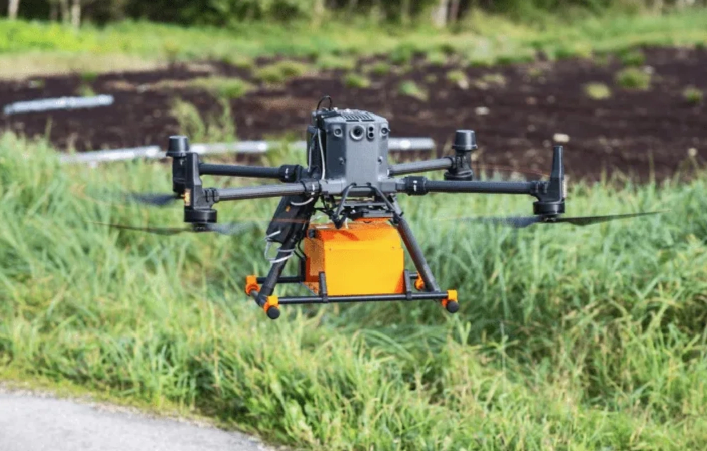
The data collected from various sources is combined into a single information model and forms a detailed map of the mine danger in the surveyed area.
One of the key advantages of the development is its ease of use: after completing the overflight, the operator simply removes the flash drive, inserts it into the computer, and in 5-10 minutes a ready-made map appears on the UADamage platform.
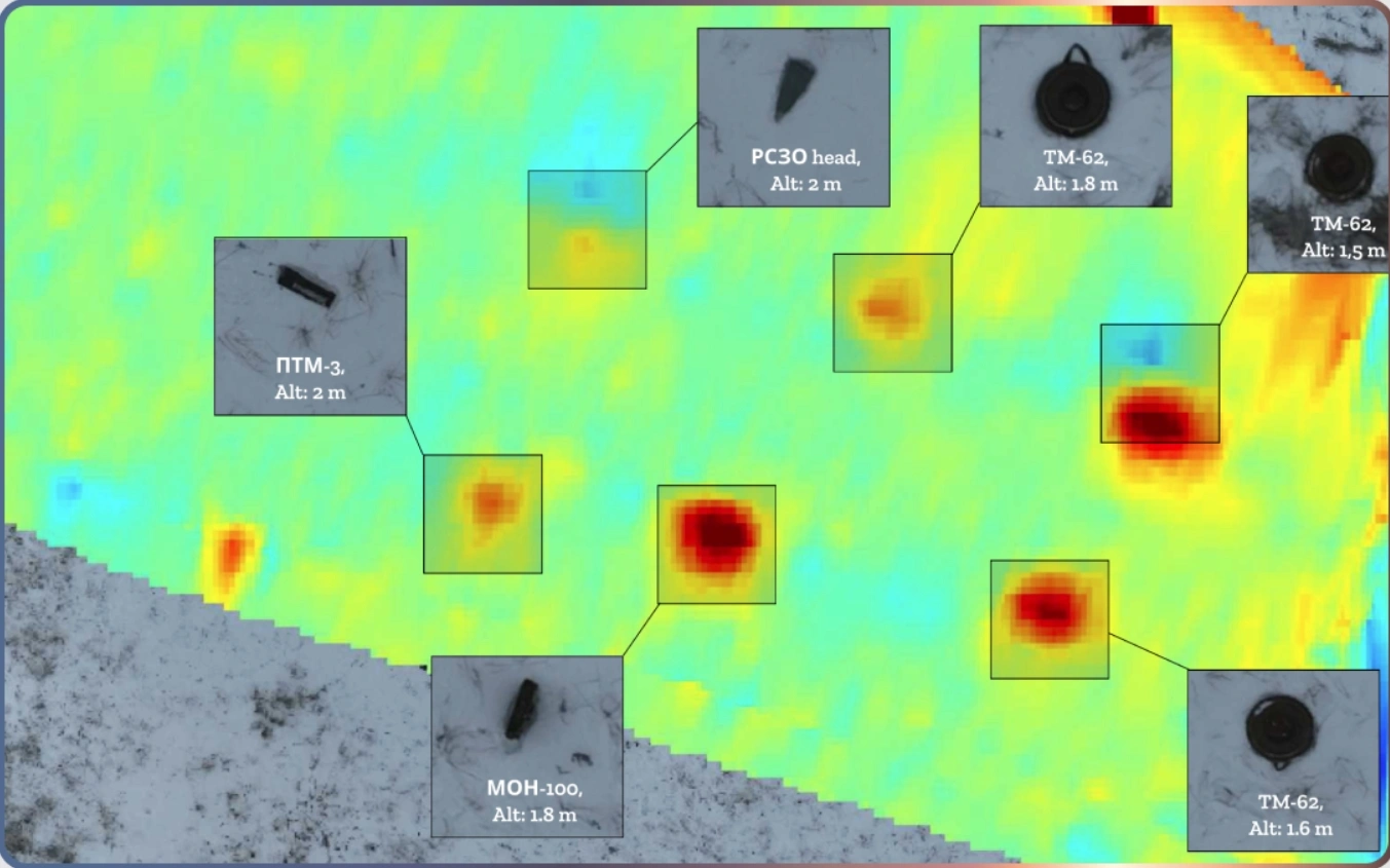
This is no longer an experimental model: the company has surveyed more than 61,000 square meters of minefields and digitized 520,000 square meters of territory upon request. Recently, UADamage, with the support of Brave1, raised $400,000 in investment to scale the technology.
A paper for the insufferable nerds among us. Who me!?!?! No you!
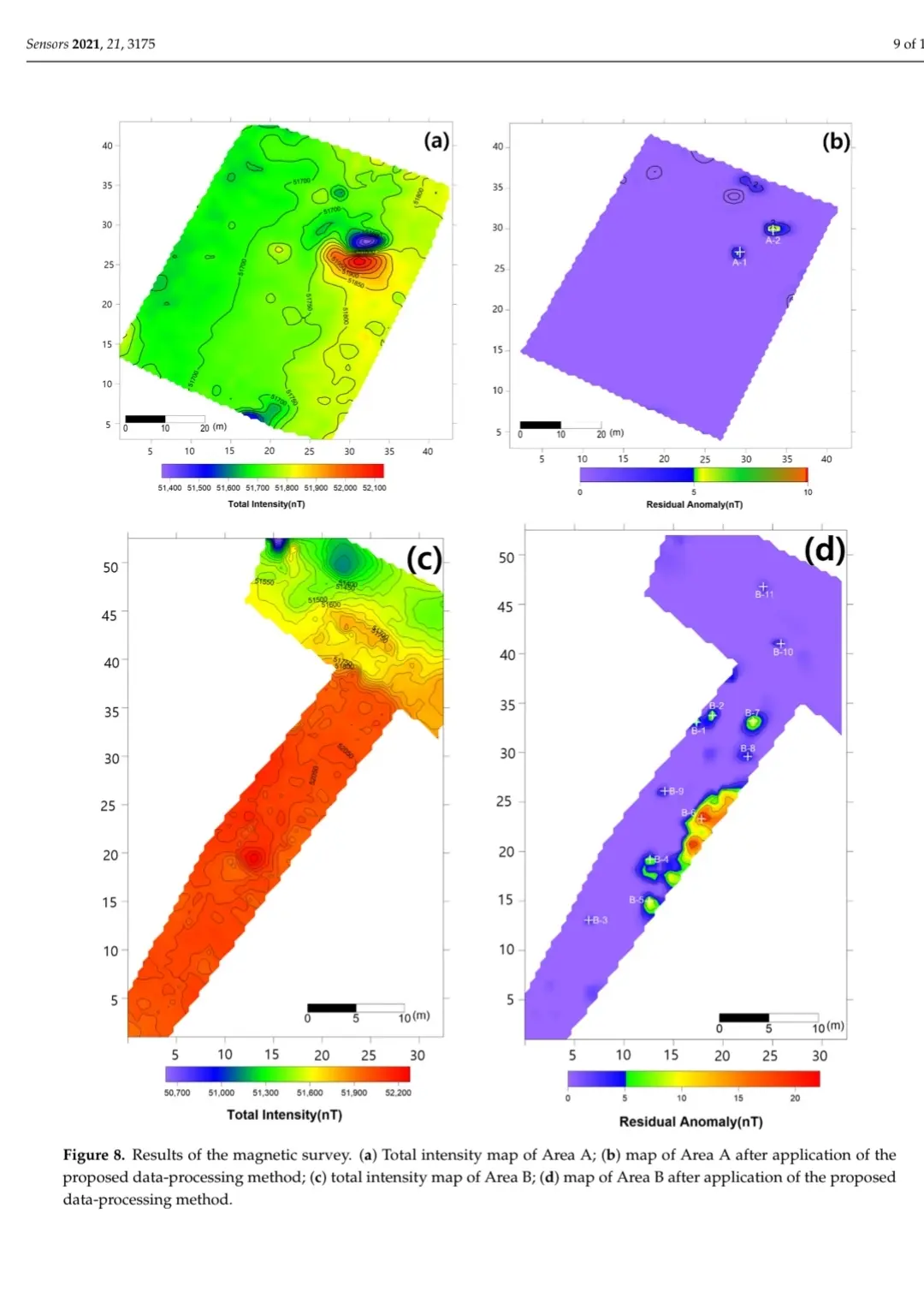
https://www.mdpi.com/1424-8220/21/9/3175
Super cool but I got to the end before my brain said “mine” not “mind” and I was really confused….
Mine detection makes a lot more sense
mines detected